Severe storms slam NYC with flash flooding, tornado threat as conditions worsen
Flights delayed, trains suspended as severe weather wreaks havoc on NYC travel
Published July 18, 2026
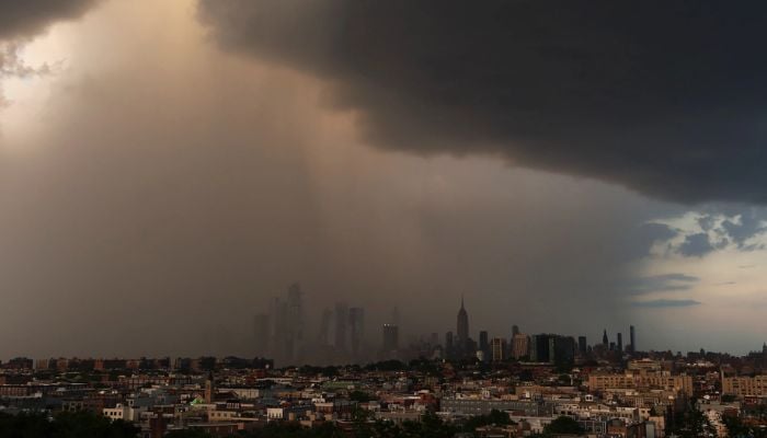
A powerful line of severe thunderstorms battered the New York City metro area Saturday, July 18.
This triggered flash flood warnings and raised the risk of isolated tornadoes as torrential downpours and damaging winds swept across the tri-state region.
Considering the weather situation, the National Weather Service issued a flash flood warning for much of the city, including Manhattan, Brooklyn, Queens, Staten Island, and parts of New Jersey.
It is estimated that the rainfall rates can exceed up to 2 inches per hour. By early afternoon, early 4 inches of rain had already fallen in some areas, and forecasters warned of additional downpours through the evening.
Gusts of damaging winds ranging from 50 to 70 miles per hour were the main threats, with authorities advising of falling trees, power lines, and airborne objects. Severe weather danger was categorized at a level 3 out of 5 in much of the tri-state area, with the highest tornado and wind threat expected in New Jersey, the Poconos and the Catskills.
NYC Emergency Management Commissioner Christina Farrell said: “Saturday’s storms will be fast-moving, but the strongest ones can produce damaging winds and intense downpours with little warning.”
“Conditions can escalate quickly, and a dry morning does not mean a dry afternoon,” she added.
Due to the storms, travel across the region has also been disrupted, with ground delays at JFK, LaGuardia, and Newark airports averaging around 95 minutes. NJ Transit suspended service in both directions Saturday afternoon due to weather conditions.
Mayor Zohran Mamdani urged New Yorkers to stay safe, saying: “If the rain picks up, winds strengthen, or you hear thunder, go inside and wait out the dangerous conditions. Check on your neighbours, especially New Yorkers living in basement apartments.”
Besides travel disruption, storms brought hope that the air quality would be improved in the region, clearing out the thick Canadian wildfire smoke that had choked the city for days.